
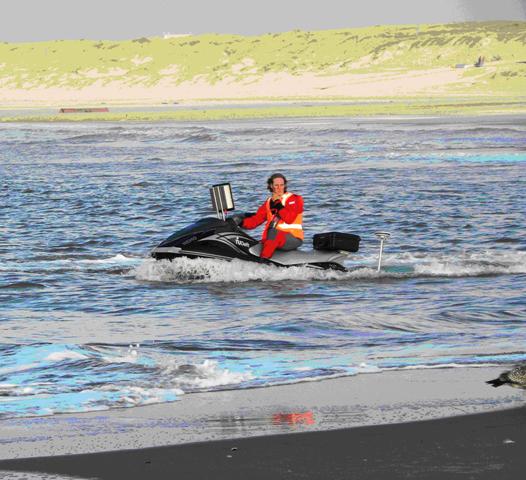
GREAT BAY, Sint Maarten (GIS) – Section Head of Disaster Management Paul Martens, says that a bathymetric survey (mapping of the sea floor) will commence in the coastal waters of Sint Maarten on Saturday. A jet ski with survey equipment attached will start from the Philipsburg area.
The survey is part of a proactive disaster management approach, "Hazard and Vulnerability Assessment Project," being taken by disaster management organizations within the region with assistance from a number of development organizations.
The aim is to examine hazards posed by inland and coastal flooding across the country. The hazards under consideration involve flash floods, coastal storm surges and tsunamis. The information derived from the survey and other research that has been done will lead to the development of a Disaster Plan as well as an early warning system.
All of this is part of the Regional Risk Reduction Initiative (R3I) project for the Dutch and United Kingdom overseas territories.
Two Dutch University Delft students will carry out the survey under the supervision of Professor Zoran Vojnovic from the hydrological institute UNESCO-IHE in Delft, The Netherlands.
UNESCO-IHE has been working on projects on Sint Maarten in the past namely, the storm water modeling for the Cul-de-Sac basin which was carried out in 2005-2006. Currently work is being executed on a similar water modeling project for the Dutch-French Quarter basin.
European Union (EU) funding has been made available for several regional projects in the field of disaster management and risk reduction.
The project is being coordinated by the United Nations Development Program (UNDP) office in Barbados. One of the projects is Early Warning Systems of which Sint Maarten is a beneficiary.
The bathymetric survey is one of the elements of this particular project. NASA will be taking satellite imagery of the island in the same time period using their E)-1 satellite to capture high resolution imagery of coastal waters during the survey period. The survey is expected to last 10-14 days or up to February 13.